



Plan. Anticipate. Adapt.
SCOUT combines First Option’s operational knowledge, our curated controls databases and AI reasoning to help you see the bigger picture, not just individual hazards.
Every output is designed to improve planning speed and consistency, and produce consultant-quality first drafts in minutes rather than hours, ready for professional review.
A four-day shoot. Eight crew. A 4×4, a drone and a night in the desert.
Sounds straightforward.
SCOUT looks beyond the brief to identify the permissions, dependencies and practical issues that could affect the production – and the questions that need answering before detailed planning begins.
Know what matters. Earlier.
See the planning output in the video
Operational Watchouts | Planning Intelligence | Regulatory Requirements | Permits & Approvals | Authorities & Stakeholders | Specialist Competence | Emergency Planning | Environmental Planning | Contractor Interfaces | Technical Resources | AI Planning Summary | Draft Risk Assessment |Operational Watchouts | Planning Intelligence | Regulatory Requirements | Permits & Approvals | Authorities & Stakeholders | Specialist Competence | Emergency Planning | Environmental Planning | Contractor Interfaces | Technical Resources | AI Planning Summary | Draft Risk Assessment |
SCOUT doesn’t treat operational issues as isolated checklist items. It analyses how locations, activities, environmental conditions and production requirements interact to identify the combinations of factors most likely to affect safe, efficient delivery: separate, minor factors can often compound into major risks traditional templates won’t identify.
Simply describe your project, add the location and operating conditions, and SCOUT does the rest. For international productions, SCOUT brings current official travel information into its analysis so it can respond to conditions on the ground now – not simply what was known when the underlying model was trained.
It produces context-aware operational intelligence, production-critical watchouts, country-specific planning considerations, regulatory guidance, technical resources and priority actions tailored to your individual project.
SCOUT combines intelligent analysis with expert-curated safety content to help you understand a project early, build a robust draft risk assessment, and identify gaps, inconsistencies and issues that may need further attention.
WHY SCOUT?
Because the best time to find a problem is while you still have choices what you don’t know at the start becomes expensive later complex projects need joined-up thinking finding information is easy - knowing what matters is harder the important risks often sit between the obvious ones
SCOUT is a production planning tool that helps you ask better questions, earlier.
Describe what you’re planning and SCOUT looks at the project as a whole – including locations, activities, logistics, contractors, permissions and emergency arrangements – and considers how those elements interact.
It helps identify the issues most likely to need attention while there is still time to investigate, adapt and make informed decisions.
SCOUT doesn’t tell you how to run your production. It helps you understand what you need to think about, what may need further investigation and where specialist input may be required. Unlike checklist-based safety tools, SCOUT starts with the production itself – not a predetermined list of questions.
No – and it isn’t trying to be.
SCOUT does something different. It helps you interrogate a project early: what’s unusual about it, what might make it difficult to deliver, what needs further investigation and where specialist input may be needed.
It doesn’t replace professional experience or judgement. It helps bring them into the process earlier – while there is still time to adapt the plan, explore alternatives and avoid preventable problems becoming expensive ones.
Technically, yes. Of course it could. But we’ve deliberately designed it not to.
Generative AI can produce risk assessments that look polished and convincing – while containing invented hazards, inappropriate controls or simply incorrect conclusions. That makes it a very poor choice for generating safety-critical content from scratch.
SCOUT takes a different approach. Its risk assessment functionality is built on structured safety content developed and maintained by competent professionals.
AI is used to help interrogate that information, identify possible gaps and highlight areas that may need further attention – but it doesn’t get to make safety decisions.
Yes – if you use it for the right things.
AI can be extremely useful in safety: helping you structure information, interrogate a plan, identify things you may have missed, summarise complex material and work out where further investigation or professional advice may be needed.
What it isn’t good at is being the safety professional. An AI-generated answer can be plausible, detailed and confidently written – while still being wrong, incomplete or inappropriate for the situation.
The important question therefore isn’t “should I use AI?” but “what should I use it for?”
Our free 15-minute audio course, Using AI in Safety, explains where these tools genuinely add value, where the risks lie, and why asking AI simply to “write me a risk assessment” may not be the shortcut it appears to be.
Productions and events are becoming more ambitious, but planning time isn’t getting any longer. Good decisions need good information – and fast.
At the same time, there’s more information available than ever. The challenge isn’t finding it; it’s identifying what’s relevant, what’s reliable and what actually matters for a particular project.
SCOUT helps make that process faster and more focused, bringing the important questions forward while there is still time to act on them – without pretending that technology can replace professional judgement.
No. Several different AI models are used within SCOUT, but SCOUT isn’t simply an AI-powered chatbot.
SCOUT combines AI with structured safety content written by professionals, defined rules and different technical approaches, depending on the task. Some parts use AI, some deliberately don’t. The principle is simple: we use AI where it adds value, not simply because it’s available.
AI can be extremely useful for interpreting complex information, spotting connections and identifying issues that may warrant further investigation. But it isn’t appropriate for every task. For example, SCOUT doesn’t ask AI to invent safety controls for a risk assessment. Those controls come from content written and maintained by competent professionals.
AI can help ask ‘have we missed something‘ but it doesn’t get to decide ‘this is how you make it safe‘. We’d never use AI where a plausible-sounding guess might create a safety problem.
No. In fact, it should help you make better use of one.
Safety advice is often sought relatively late, when a project is already committed to a location, a schedule or a particular way of working. At that point changes may still be possible – but are usually harder and more expensive.
SCOUT helps identify potential issues earlier. So when specialist advice is needed, you’re better placed to ask the right questions and get the right input while practical choices are still available to you.
No. And that’s rather the point.
You describe your production or event in production language: what you’re doing, where you’re doing it, and how you expect it to work.
SCOUT connects that information to the operational and safety questions that might follow. It can also bring in wider context that may affect the plan – for example, whether a location could be affected by monsoon conditions, wildfire risk or El Niño during the period you expect to be there.
You don’t need to know every question to ask in advance. Helping you identify what matters is part of what SCOUT is designed to do.
No. SCOUT is designed to work in stages.
There are three parts. Operational Planning helps you think through what you’re proposing. The Risk Assessment module draws on structured safety content so you can build and adapt the controls for what you’re actually doing. Review then looks across both and helps identify possible gaps, inconsistencies or areas that need further attention.
You don’t have to complete all three in one sitting. You can return as the production develops, update what’s changed and run the relevant parts again. That matters because productions and events evolve – and your planning needs to evolve with them.
Yes – but not by adding more paperwork.
The biggest opportunities to reduce risk often come before anyone starts writing a risk assessment: when you’re choosing locations, designing activities, appointing contractors and shaping the schedule.
SCOUT starts where those important decisions are still being made, helping put potential issues on the radar while there’s still time to change the plan, explore alternatives and make better-informed decisions.
The aim isn’t more paperwork. It’s better planning, earlier.
No – and you should be very wary of any system that claims it can.
Safety depends on what actually happens: the people involved, the conditions on the day, the equipment being used, the level of supervision and whether the planned controls are actually put into practice.
SCOUT can help you identify what needs attention, challenge the plan and highlight potential gaps. What it can’t do is observe what happens on the day and pronounce a production ‘safe’.
That judgement depends on the reality of the production – not an answer generated on a screen.
Possibly nothing. But that’s not really the point.
SCOUT takes everything you’ve told it about a project and looks across it systematically, helping identify connections and interactions that can be easy to miss – especially when different aspects are being planned by different people.
Sometimes it will identify something new. Sometimes it will confirm what you already suspected. And sometimes its value is simply in asking the question that nobody else has asked yet.
The point isn’t that SCOUT knows more than you do. It’s that it can help you see the whole picture.
No. Your production information isn’t used to train SCOUT or to inform answers given to other users.
Also, your inputs and SCOUT’s outputs remain your intellectual property: using SCOUT doesn’t transfer ownership of your ideas, content or production material to us or anybody else.
But as a general rule, tell SCOUT what it needs to know – not everything you know: it’s good practice to avoid including any unnecessary personal, confidential or operationally sensitive information.
Only if you press ‘Submit’ (or ‘Save and Continue Later’).
You can still use SCOUT without saving or submitting anything – but if you do submit, your project information and SCOUT outputs are saved securely in your SCOUT Library, so you can return to review, edit or update them later.
ABOUT SCOUT
SCOUT IN ACTION
SCOUT is loaded with time-saving features. Try typing a location town or city – anywhere in the world – in the box below.
We’ve run a few possible production scenarios through SCOUT to demonstrate the sort of outputs you can expect.
Scenario 1: Remote Documentary
“A small documentary team is filming marine conservation activity along a remote exposed coastline involving drone filming, boat transfers, cliff-top access, and filming from unstable shoreline terrain.
The production includes cold-water exposure, changing weather conditions, intermittent communications coverage, limited nearby emergency support, and extended travel times for rescue or evacuation.”
Location: Ushuaia | Season: Autumn
Production Planning Summary
Operational complexity is driven by remote coastal access, winter conditions, marine movements, drone permissions, limited communications and long response times. Delivery will depend on weather windows, vessel availability, shoreline access decisions, aviation constraints near Ushuaia, and alignment with maritime, municipal and provincial authorities. The defining characteristic is a small crew operating across exposed land, sea and air environments with little local redundancy.
Strategic Watchouts
Weather Windows Drive the Schedule
Winter coastal conditions will dictate usable filming periods more than the editorial plan.
Marine and Shoreline Access Are Interdependent
Boat transfers, landing points and cliff-top routes must be planned as one operating system.
Drone Permissions May Shape Locations
Ushuaia airspace, proximity to aviation activity and coastal restrictions may limit flight options.
Low Local Redundancy
Limited communications and extended response times reduce flexibility for schedule changes or unsupported location moves.
Operational Planning Considerations
Remote Coastal Logistics
The main planning issue is not crew size but the lack of nearby support once the team is committed to a coastline section. Recce work should establish practical access points, turnaround times, landing options, vehicle positioning and realistic movement rates across shoreline and cliff-top terrain. The production should decide early whether each location is serviced primarily by road, foot or vessel, because that choice affects call times, equipment load, weather tolerance, communications planning and the ability to change position during the day.
Marine Operations
Boat transfers are likely to become the pacing item for the shoot, particularly if embarkation points, sea state limits and landing areas are restrictive. Vessel selection, skipper availability, passenger capacity, equipment carriage and return windows need to be fixed before the filming schedule is locked. Any conservation activity involving third-party boats should be treated as a shared operation rather than background action, with clear agreement on who controls movements, timings, passenger manifests and decisions to stand down.
Drone Filming
Drone planning should start with airspace, landowner and operational permissions rather than shot lists. Ushuaia’s aviation environment, coastal winds and potential protected areas may materially affect where flights are possible and how much useful aerial time is achievable. The production should confirm whether drone work is being carried out by a local Argentine operator or an incoming operator, as that will influence authorisations, documentation, insurance, equipment import arrangements and the lead time needed before principal photography.
Communications and Response Planning
Intermittent coverage and long evacuation times will influence the practical size of the operating area each day. Location selection should be tested against communications reach, vehicle access, vessel return time, nearest medical provision and the ability to maintain contact between cliff-top, shoreline and boat teams. Early decisions are needed on whether satellite communications, dedicated marine communications or local support personnel are required, because these affect crewing, budget and the number of simultaneous filming positions that can be supported.
Winter Scheduling
Winter in Ushuaia compresses the working day and increases the likelihood that weather will drive short-notice changes. Day and night filming should be scheduled around realistic daylight, tidal timing, marine availability and travel time back to accommodation, rather than standard production day assumptions. The production should build the schedule around primary and secondary coastal options, with decisions made early on how much contingency is held locally and which sequences can be filmed inland if the coast is unavailable.
Stakeholder Coordination
The conservation activity will likely involve local organisations, maritime authorities, land managers or protected-area interests whose operating priorities may not align with filming needs. Access, boat movements, drone flights and public or environmental sensitivities should be coordinated before crew travel. The production should identify who has decision-making authority over each coastline section, vessel movement and conservation activity, because unclear ownership will delay permissions and make daily planning vulnerable to last-minute changes.
Questions To Resolve
- Which exact coastline sections, landing points and cliff-top access routes are being considered?
- Will boat transfers be provided by the conservation team, a charter operator or production-contracted vessels?
- Is drone filming being carried out by an Argentine-authorised operator or by an incoming production operator?
- Are any locations inside or adjacent to protected areas, port zones or restricted aviation areas?
- What communications coverage has been confirmed at each proposed filming position?
- How much winter weather contingency is available within the shoot schedule?
Authorities and Key Organisations
Prefectura Naval Argentina
National maritime authority relevant to coastal operations, vessel movements and marine coordination in Argentine waters. Visit website
Administración Nacional de Aviación Civil
Argentina’s civil aviation authority, relevant to drone permissions and airspace requirements. Visit website
Municipalidad de Ushuaia
Local municipal authority for filming coordination, local access matters and city-level permissions in Ushuaia. Visit website
Gobierno de Tierra del Fuego, Antártida e Islas del Atlántico Sur
Provincial government relevant to regional permissions, public land, emergency coordination and local institutional liaison. Visit website
Servicio Meteorológico Nacional
Argentina’s official meteorological service for weather intelligence affecting coastal, marine and winter scheduling decisions. Visit website
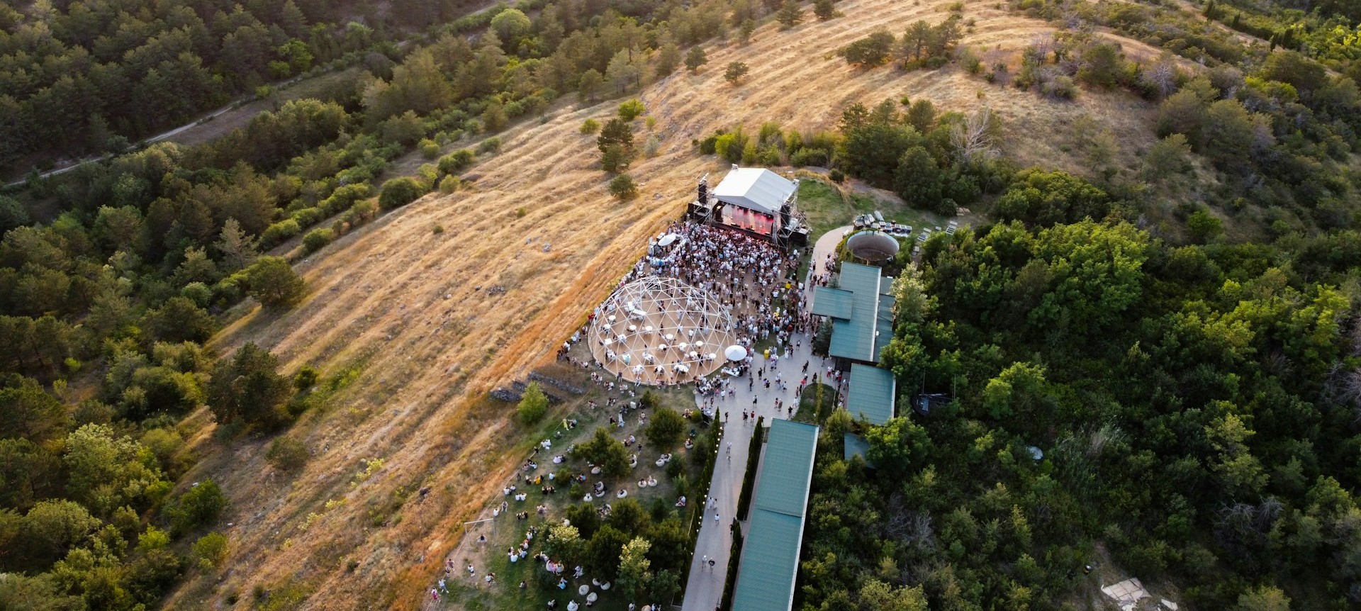
Scenario 2: Large Festival Build
“A live outdoor event is preparing for a three-day music festival involving temporary staging, lighting towers, suspended audio systems, generators, crowd barriers, food concessions, and overnight security operations.
The site is exposed to high winds and heavy rain risk, with large vehicle movements during build and breakdown phases. Multiple contractors are operating simultaneously across the site while public access areas are being progressively opened during final construction activity.”
Location: Roskilde | Season: Summer
Production Planning Summary
Large, weather-exposed festival delivery with overlapping construction, contractor activity, public opening, night operations and high-volume logistics. The defining dependencies are site phasing, structural sign-off, power distribution, traffic management, concession integration, security continuity and weather decision points. External influence will come from Roskilde Municipality, Danish workplace authorities, emergency services, police, utilities and weather information providers.
Strategic Watchouts
Progressive Public Opening
Public access during final construction will heavily shape zoning, handover sequencing and contractor movement planning.
Weather-Dependent Infrastructure
Staging, towers, suspended systems and temporary power all depend on early weather thresholds and response sequencing.
Contractor Density
Simultaneous build activity across staging, power, barriers, concessions and logistics will drive coordination load.
Night-Time Site Continuity
Overnight security, generators and partially completed infrastructure create a continuous operating environment, not a day-only build.
Operational Planning Considerations
Temporary Structures and Technical Infrastructure
The staging, lighting towers, suspended audio systems and barrier lines create a structural and technical package that needs early integration rather than separate supplier planning. Load paths, ballast assumptions, wind actions, rigging points, certification routes and inspection windows will affect build sequencing and public-area release. Technical suppliers will need aligned handover milestones so structural completion, audio suspension, lighting installation, power energisation and public readiness do not compete for the same space or plant during final preparation.
Site Phasing and Public Interface
Progressively opening public areas while final construction continues is likely to be the main operational constraint. The site will need a clear phasing logic showing which areas remain contractor-controlled, which are released for public use, and how those boundaries change by day and hour. This affects access routes, stewarding deployment, concessions opening, emergency access, vehicle curfews, signage and final inspections. Early decisions are needed on whether public opening is tied to area-by-area completion or a single whole-site readiness point.
Contractor Coordination and Build Logistics
Large vehicle movements during build and breakdown, combined with multiple contractors working simultaneously, will require a centralised site logistics model. Delivery slots, crane or plant access, compound locations, waste routes, fuel movements, concession fit-out and technical supplier dependencies should be planned as one programme. Breakdown is likely to be as complex as build because contractors will want rapid access while public egress, waste removal and asset recovery are still active. The production will need early agreement on site traffic hierarchy and contractor access priorities.
Power, Fuel and Concessions
Generators, food concessions, lighting, audio and overnight security create a continuous temporary services environment. Power distribution, generator placement, refuelling windows, concession energisation, water and waste servicing will all affect the site layout and operating schedule. Concessions are not simply retail units; they influence vehicle access, public circulation, waste volume, staff accreditation and utilities demand. Early planning should establish whether concession services are centrally managed by production or delivered through individual vendor arrangements.
Weather and Operational Decision Points
Summer timing does not remove the planning significance of wind and heavy rain on an exposed site. Weather planning will shape structural sign-off, ground protection, vehicle routing, crowd-area readiness, technical suspension decisions and show-day operating thresholds. The key planning issue is not the forecast itself but who receives weather intelligence, who interprets it operationally, and when decisions are made. These decision points should be embedded into build, show and breakdown programmes before suppliers finalise methods and staffing.
Security, Overnight Operations and Site Continuity
Overnight security means the site remains operational between public days and during incomplete build states. Security planning will need to align with contractor access, asset protection, generator operation, fuel management, welfare, lighting, emergency access and handover between production, suppliers and stewards. The overnight period may also become the only practical window for certain deliveries, inspections, repairs and waste movements. Early decisions are needed on command structure, reporting lines and whether security has authority over contractor access outside production hours.
Questions To Resolve
- Which areas are intended to open to the public before all construction activity has fully completed?
- Who will hold overall authority for weather-related operational decisions during build, show days and breakdown?
- Are temporary structures and suspended systems being supplied under one technical coordinator or multiple independent contractors?
- What vehicle access routes remain available once public areas begin opening?
- Will food concessions be centrally serviced or individually responsible for power, water, waste and deliveries?
- What overnight activities are expected beyond security presence, including deliveries, refuelling, inspections or technical work?
Authorities and Key Organisations
Roskilde Kommune
Local municipality likely to influence event permissions, land use, public space, noise, waste and local coordination. Visit website
Arbejdstilsynet
Danish Working Environment Authority relevant to contractor coordination, construction-phase work and workplace compliance. Visit website
Sikkerhedsstyrelsen
Danish Safety Technology Authority relevant to electrical installations, gas use and technical safety regulation. Visit website
Danmarks Meteorologiske Institut
National meteorological service providing official weather information relevant to wind, rain and operational decision timing. Visit website
Scenario 3: Urban Commercial Shoot
“A large commercial production plans to film a high-energy vehicle sequence in a live urban environment involving tracking vehicles, drone filming, controlled road holds, pyrotechnic effects, and filming adjacent to members of the public.
The production includes overnight filming, temporary lighting structures, intermittent rain, restricted access routes, and coordination with local authorities, police, and transport providers. Crew movement between multiple nearby locations is required under tight time pressure.“
Location: New York | Season: Summer
Production Planning Summary
Operational complexity is high because vehicle action, aerial filming, road holds, pyrotechnics, public proximity and overnight infrastructure all compete for the same urban space. Delivery will depend on early alignment between filming permissions, traffic management, NYPD involvement, FDNY requirements, FAA permissions, transport interfaces, lighting placement and unit movement across constrained nearby locations.
Strategic Watchouts
Road Holds Drive the Schedule
Intermittent traffic control will dictate shot order, reset time, crew positioning and achievable overnight volume.
Drone Use Is Highly Constrained
Urban airspace, NYC operating restrictions and proximity to public activity will shape whether aerial coverage is practical.
Pyrotechnics Affect Location Viability
Special effects requirements may determine which streets, timings and camera positions can realistically be permitted.
Compressed Location Moves
Multiple nearby locations under time pressure will make parking, holding, access routes and communications central to delivery.
Operational Planning Considerations
Vehicle Sequence and Road Operations
The vehicle work is the operational spine of the shoot and will determine permit scope, police involvement, traffic holding patterns, camera positions, reset routes and public-facing boundaries. Early planning needs to establish whether the sequence can be delivered through intermittent traffic holds or requires fuller street control, and whether tracking vehicles, picture vehicles, drone windows and pyro moments can share the same lock-up pattern. The production should resolve where vehicles stage, turn around, refuel, reset and exit without relying on streets that may be blocked by the filming activity itself.
Authority Coordination and Permit Sequencing
This production will require joined-up sequencing between the NYC film permit process, traffic approvals, police deployment, transport stakeholders, special effects approvals and any aviation permissions. The principal planning issue is not simply obtaining separate permissions, but ensuring they describe the same operating model, timings, locations and public interface. Early submissions should be based on a realistic technical plan rather than a broad creative intention, because later changes to road holds, effects placement, drone activity or lighting positions can trigger fresh review and affect crew call times, location agreements and overnight working windows.
Drone Filming in an Urban Environment
Drone filming in New York City will need to be treated as a separate planning stream rather than an add-on to the camera plan. The feasibility will be shaped by FAA requirements, local operating restrictions, nearby airspace activity, street geometry, take-off and landing positions, public proximity and whether the required angles can be achieved within permitted operating areas. Early decisions should confirm whether the drone is essential to the sequence, whether alternate aerial platforms are being considered, and how drone windows align with road holds, lighting levels, pyro timing and public management.
Pyrotechnics and Special Effects Integration
Pyrotechnic effects will influence location selection, authority review, scheduling and technical layout. Their placement must be coordinated with vehicle paths, camera coverage, lighting structures, public-facing edges, overnight noise expectations and reset time. The key early decision is whether effects are embedded in the live vehicle action or filmed as separate beats, because that changes the road-hold model, crew positioning, specialist attendance and turnaround between takes. FDNY expectations, effect scale, storage arrangements and timing limitations should be understood before locking streets, camera routes or public notification plans.
Temporary Lighting, Overnight Work and Summer Conditions
Overnight filming with temporary lighting structures will affect parking footprint, generator placement, cable routes, lift access, pedestrian movement, nearby residents and coordination with rain cover. Summer conditions in New York add planning pressure through heat, humidity, thunderstorms and fast-changing wet weather, particularly where lighting, grip, vehicles and drone timing are interdependent. Early planning should confirm where lighting infrastructure can be placed without compromising road holds or emergency access, whether rain materially changes the intended look, and how overnight noise, load-in and strike windows align with local expectations.
Multi-location Logistics and Public Interface
The compressed movement between nearby urban locations will require a detailed operating geography, not just a call sheet sequence. Crew, cast, picture vehicles, tracking vehicles, effects teams, drone crew, lighting units and holding areas will all compete for kerb space and access routes. Public adjacency will also influence lock-up patterns, communication points and the practicality of resets. Early planning should decide whether the production operates from one controlled base with satellite working areas or relocates the unit repeatedly, as that decision will drive parking, transport, security, meal logistics and turnaround discipline.
Questions To Resolve
- Which streets, intersections and kerb spaces are required for action, staging, technical vehicles and public-facing lock-ups?
- Are road holds intended to be intermittent, rolling, or full closures for specific filming windows?
- Is drone filming essential to the creative, and what approved take-off, landing and operating areas are available?
- What scale and placement of pyrotechnic effects are proposed relative to vehicle action and camera positions?
- How many separate location moves are planned during the overnight period, and what is the maximum acceptable reset time?
- Which transport providers or routes are affected by the proposed holds, diversions or overnight access restrictions?
Authorities and Key Organisations
NYC Mayor’s Office of Media and Entertainment
Primary city office for film permitting and coordination of production activity on New York City property. Visit website
New York City Police Department
Key city agency for police support, public street activity, traffic holds and on-street coordination where required. Visit website
New York City Department of Transportation
Relevant authority for streets, traffic management, parking, lane use and transport impacts on city roadways. Visit website
Fire Department of the City of New York
Relevant authority for pyrotechnics, fire-related permits, special effects review and related operational requirements. Visit website
Federal Aviation Administration
Federal authority for drone operations, airspace authorisations and unmanned aircraft requirements in the United States. Visit website
Metropolitan Transportation Authority
Relevant transport provider where filming affects subway, bus, rail, bridge, tunnel or transit-adjacent operations. Visit website


